38 districts of Bihar
What is the name of 38 districts in Bihar? In this article you will find all the district of Bihar with brief history and pictures.
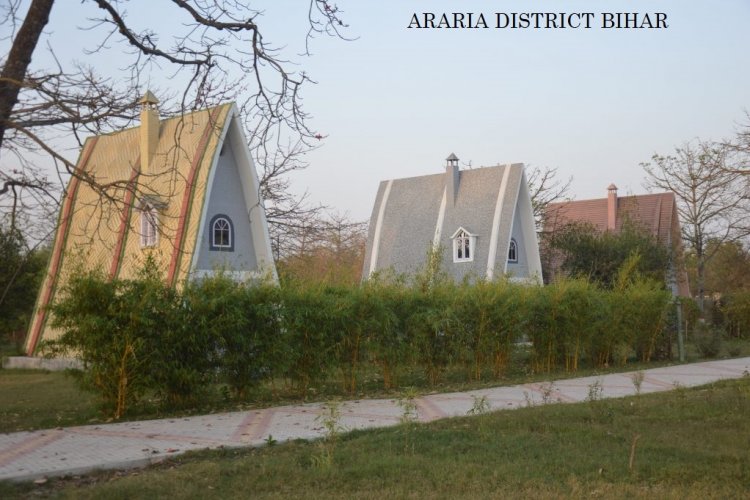
1. ARARIA , BIHAR
ARARIA IS ONE OF THE 38 DISTRICT'S OF BIHAR
Araria has a very significant history of the past but the name of the district comes from the R Area or residential area of Mr. Forbes
2. Arwal, Bihar
ARWAL DISTRICT BIHAR
Arwal district is part of Bihar state. Arwal is situated on the side bank of river Son, Arwal Town is the headquarter of this District. Arwal is an important and one of the thirty-eight districts of Bihar.
3. Aurangabad, Bihar
Aurangabad, Bihar
Aurangabad is an important and one of the thirty-eight districts of Bihar. Aurangabad is also Known as 'Chittorgarh of Bihar'. Aurangabad came into existence in the year 1972 when it was split from Gaya District, Bihar.
Daudnagar is also a major tourist spot in this district and you can visit Daud fort easily.
4. Kaimur, Bihar
Kaimur, Bihar
Kaimur was established on 17 March 1991 when It was divided from Rohtas District. It was called Bhabhua District Until 1994, In 1994 it was renamed to Kaimur District. The
The district headquarters is Bhabhua District. Kaimur District is a part of Patna Division.
5. Katihar, BIHAR
Katihar, Bihar
Katihar is one of the Thirty-eight District of Bihar and a historical city Located near the border of West Bengal. Tri-Mohini Sangam and Goga Bali Lake are some of the main attractions you can visit in the district. On 2 October 1973 Katihar was established as an independent district.
6. Kishanganj, Bihar
Kishanganj, Bihar
Kishanganj is an important and one of the thirty-eight districts of Bihar. Kishanganj Town is also the administrative headquarters of Kishanganj District also. The Kishanganj district separated from Purnia district on 14 January 1990.
7. Khagaria, Bihar
Khagaria, Bihar
Khagaria is an important and one of the thirty-eight districts of Bihar.
Khagaria was a part of the district of Munger, as a subdivision. The sub-division of Khagaria was created in the Year 1943-44. It was upgraded as district, with effect from 10th May, 1981
8. Gaya, Bihar
Gaya, Bihar
Gaya is a holy city beside the Falgu River, in the northeast Indian state of Bihar. It’s known for 18th-century Vishnupad Mandir, a riverside temple with an octagonal shrine. Close by, ancient Mangla Gauri Temple is set on a hilltop. To the north,
9. Gopalganj, Bihar
Gopalganj, Bihar
Gopalganj is a district in Bihar State of India. It has a total of 14 Blocks in this district. It is one of the important and old districts of Bihar state.
10. Jamui, Bihar
Jamui, Bihar
JAMUI district came into existence on 21st of February 1991 after being carved out from the district of Munger. Since 1889 Jamui has been a sub-division of Munger.
Historically, Jamui has been an important place in Bihar.
11. Jehanabad, Bihar
Jehanabad, Bihar
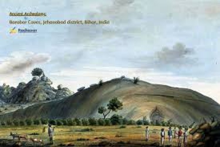
Jehanabad was carved out of old Gaya district on 1st August, 1986. It was a sub-division of the Gaya since 1872. The main aim behind the creation of this district was to accelerate the pace of development in tandem with tackling the problems of extremism, poverty, unemployment and under development.The city of Jehanabad, which is the head quarter of the district, is situated at the confluence of the rivers Dardha & Yamuna.
12. Darbhanga, Bihar
Darbhanga, Bihar
The district takes its name from its only town Darbhanga the District headquarters, which is said to have been founded by one Darbhangi Khan, about whom practically nothing is known. It is also held that the name Darbhanga has been derived from Dwar Banga or Dari – Banga, meaning the ‘door of Bengal’. This derivation does not appear to be very correct as the division between Bengal and Bihar has always been further to the east. However, the linguistic and cultural affinity with Bengal may be said to commence from here.
13. Nawada, Bihar
Nawada, Bihar
In 1845, it was established as a Subdivision of the Gaya district. On 26th January 1973, Nawada was formed as a separate district. The origin of the name Nawada is believed to lie in a corruption of the old name Nau-Abad or the new town which was earlier known as ‘The Eliot Market (Bazaar)’. It is divided into two parts by Khuri River, the portion on the left bank being the older, while that on right bank is modern and contains public offices, sub-jail, dispensary and school.
Famous “Sarvoday Ashram” inaugurated by Desh Ratana Dr. Rajendra Prasad and nourished by Shree Jai Prakash Narayan has enhanced the glory of Nawada.
14. Nalanda, Bihar
Nalanda, Bihar
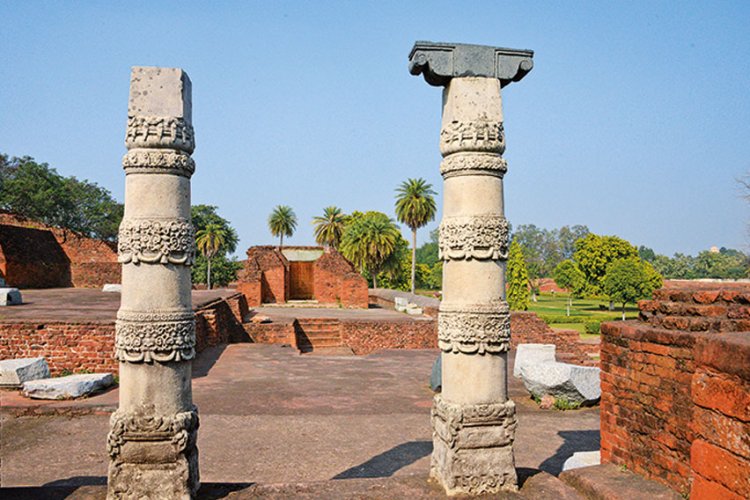
Nalanda was an acclaimed Mahavihara, a large Buddhist monastery in the ancient kingdom of Magadha (modern-day Bihar) in India. The site is located about 95 kilometres southeast of Patna near the town of Bihar Sharif, and was a centre of learning from the fifth century CE to1200 CE. It is a UNESCO World Heritage Site.
The highly formalized methods of Vedic learning helped inspire the establishment of large teaching institutions such as Taxila, Nalanda, and Vikramashila which are often characterised as India’s early universities. Nalanda flourished under the patronage of the Gupta Empire in the 5th and 6th centuries and later under Harsha, the emperor of Kannauj.The liberal cultural traditions inherited from the Gupta age resulted in a period of growth and prosperity until the ninth century. The subsequent centuries were a time of gradual decline, a period during which the tantric developments of Buddhism became most pronounced in eastern India under the Pala Empire.
15. Patna, Bihar
Patna, Bihar
The history and tradition of Patna go back to the earliest dawn of civilization. The original name of Patna was Pataliputra or Patalipattan and its history makes a start from the century 600 B.C. The name Patna has undergone many changes at its earliest stages like Pataligram, Kusumpur, Patliputra, Azimabad etc., ultimately terminating to the present one. Chandragupta Maurya made it his capital in the 4th century B.C. Thereafter the city lost its importance until Sherkhan Suri rose into power in the early 16th century A.D. Another version that comes to focus is that there existed a village named Pattan or Patthan, which later turned into Patna.It has been said that Pataliputra was founded by Ajatashatru. Patna, therefore, has become inextricably bound up with the ancient Pataliputra. The ancient village was named ‘Patali’ and the word ‘Pattan’ was added to it. Greek history mentions ‘Palibothra’ which perhaps is Pataliputra itself.
Ajatashatru had to adopt certain security measures in order to protect Patna from the repeated Lichchavi invasions. He had got a natural riverine fort protected by three rivers. Ajatashatru’s son had moved his capital from Rajagriha to Pataliputra and this status was maintained during the reign of the Mauryas and the Guptas. Ashoka the Great administered his empire from here. Chandragupta Maurya and Samudragupta, valliant warriors, took Pataliputra as their capital. It was from here Chahandragupta sent forth his army to fight the Greeks of the western frontier and Chandragupta Vikramaditya repelled the Shakas and the Huns from here. It was there that the Greek ambassador Megasthenes stayed during the reign of Chandragupta Maurya. The famous traveler Fa-Hien in the 3rd century and Hiuen-Tsang in the 7th century inspected the city. Many noted scholars like Kautilya stayed here and works like ‘Arthashastra’ were written from this place. This city was the fountainhead of the spring of knowledge and wisdom in ancient times.
Prince Azim-us-Shan, the grandson of Aurangzeb came as the Governor of Patna in 1703. Earlier than that Sher Shah had removed his capital from Biharsharif to Patna. It was prince Azim-us-Shan who tried to turn Patna into a beautiful city and it was he who gave it the name ‘Azimabad’. The common people however went on calling it ‘Patna’. The old Patna or the modern Patna City had at one time a wall all round, the remains of which can still be seen at the entrance of old Patna.
16. West Champaran, Bihar
West Champaran, Bihar
West Champaran District was carved out of the old Champaran District in the year 1972 as a result of re-organization of the district in the state. It was formerly a subdivision of Saran District and then Champaran District with its Headquarters as Bettiah. It is said that Bettiah got its name from Baint (Cane) plants commonly found in this district. The name Champaran is a degenerate form of Champaka aranya, a name which dates back to the time when the district was a tract of the forest of Champa (Magnolia) trees & was the abode of solitary ascetics.
As per District Gazetteer, it seems probable that Champaran was occupied at an early period by races of Aryan descent and formed part of the country in which the Videha empire ruled. After the fall of Videhan empire the district formed part of the Vrijjain oligarchical republic with its capital at Vaishali of which Lichhavis were the most powerful and prominent. Ajatshatru the emperor of Magadh, by tact and force annexed Lichhavis and occupied its capital, Vaishali. He extended his sovereignty over Paschim Champaran which continued under the Mauryan rule for the next hundred years. After the Mauryas, the Sungas and Kanvas ruled over the Magadh territories. The district thereafter formed part of the Kushan empire and then came under the Gupta empire. Along with Tirhut, Champaran was possibly annexed by Harsha during whose reign Huen- Tsang, the famous Chinese pilgrim, visited India. During 750 to 1155 AD, the Palas of Bengal were in the possession of Eastern India and Champaran formed the part of their territory. Towards the close of the 10th century Gangeya Deva of the Kalacheeri dynasty conquered Champaran .He was succeeded by Vikramaditya of the Chalukya dynasty.
17. Purnia, Bihar
Purnea has a rich history and a glorious past. It is believed that the name Purnea originates either from the Goddess Puran Devi (Kali) or from Purain meaning Lotus. The earliest inhabitants of Purnea were Anas and Pundras. In the epics, the Anas are grouped with the Bengal tribes and were the eastern most tribes known to the Aryans during the period of Atharva Samhita while the Pundras, although they had Aryan blood were regarded as degraded class of people in the Aitarya Brahmana, Mahabharata and Manu Samhita, because they neglected the performance of sacred rites. According to the legend of Mahabharata, Biratnagar which gave shelter to the five Pandava brothers during their one-year incognito exile, is said to be located in Purnea.
During the Mughal rule, Purnea was a military frontier province under the command of a Faujdar. The revenue from this outlying province was spent on the maintenance of troops for protecting the borders against tribes from the north and east. According to Ain-i-Akbari, Purnea was a Sarkar within the Subah of Bengal.Purnea became a possession of East India Company in 1765 and was formed as a district on 10th February 1770. Rambagh was a famous European settlement while Sarsi was a famous indigo centre under the Europeans.Swadeshi movement and Kissan Sabha movement figured prominently in Purnea district during the early 20th century.
18. East Champaran, Bihar
From epic time till today, the history of Champaran has been glorious and important. It is mentioned in the Purana that the devotee Dhruv, son of King Uttanapada, here had done terrible penance for attaining knowledge at the place called Tapovan. On the one hand, the land of Champaran is sacred due to the Goddess of Sita, on the other hand, the Satyagraha of Gandhiji in modern India is an invaluable page in the history of Indian independence. At the time of King Janak, this was part of the Tirahut kingdom. People believe that Jankigharh, also known as Chanchigarh, was the capital of King Janak’s Veeveda state. Which later became part of the Vaishali empire in the 6th century BC. Lord Buddha had given his sermons here, in memory of which in the 3rd century BC, Priyadarshi Ashok made pillars and constructed stupas. After the decline of the Gupta Dynasty and the Pala Dynasty, the entire Champaran region, including Mithila, became subject to the Karnat dynasty. Local satraps were directly ruled by Muslims until and after this. Mahatma Gandhi came to Motihari in April 1917 on the call of Prince Shukla, a rayat of freedom and freedom fighter of India during the freedom struggle, and successfully used the first successful experiment of Satyagraha in protest of the three acrimonious cultivations of the Nil crop. This was the beginning of the new phase in the fight for independence. Later, Bapu came here many times. The British had made Champaran an independent unit in 1866, but in 1971 it was divided into Eastern and Western Champaran.
19. Buxar, Bihar
The present district of Buxar consists of areas under Buxar Sadar and Dumraon Sub-Division of the old Bhojpur district and came into existence in the year 1991. Buxar town is the headquarter of the district and also its principal town. The district is bounded on the north by the Ballia district of U.P., on the south by Rohtas district, on the west by Ghazipur and Ballia districts of U.P. and on the east by Bhojpur district.
Buxar district consists of 2 Sub-divisions and 11 Blocks. Of the 11 Blocks, 7 are in Dumraon Sub-division while 4 are in Buxar Sadar Sub-division. A town is located each in Buxar and Dumraon Sub-division. All the blocks and the towns of the district are distributed within the Sub-division as below: -
20. Banka, Bihar
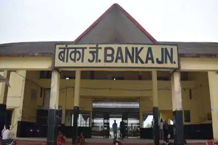
This district is situated on the south-east side of Bihar State. The Eastern and Southern border of this district is adjacent to the Jharkhand State. Western border is adjacent to Jamui district and North-West side to Munger district and is adjacent to North Bhagalpur. Geographical Area of the District is 3020 sq. kms. The Headquarters of this District is situated in Banka town. This district was established on 21st February, 1991. Prior to this, it was a subdivisional town of Bhagalpur. To run the administration properly it is divided into one subdivision Banka, eleven Blocks comprising 2111 villages constituting 185 panchayats and two urban sectors, viz; Banka (Nagar Panchayat) and Amarpur (Nagar Panchayat).
21. Begusarai, Bihar
Begusarai, Bihar
Begusarai is the industrial capital of Bihar. it is one of the 38 districts in the Bihar state India.
Begusarai town is the administrative headquarters of Begusarai district, which is one of the thirty-eight districts of Bihar state, India. The district lies on the northern bank of the river Ganga. It is located at Latitudes 25.15N & 25.45N and longitudes 85.45E & 86.36E. It was established in 1870 as a subdivision of Munger District. In 1972 it was established as a district. The name of the district apparently comes from “Begum” (queen) + “Sarai” (inn) as “Begum” of Bhagalpur used to come to the “Simaria Ghat” (a holy place at Ganges bank) for a month of pilgrimage which later took the present slang form Begusarai
It is the birthplace of famous Hindi poet Rashtrakavi Ramdhari Singh Dinkar. (However, most people know Munger as his birthplace as Begusarai was the part of Munger during his birth and much of his lifetime.) and Eminent Historian Professor Ram Saran Sharma. Begusarai is part of the historic Mithila region. Eminent Historian Professor Ram Sharan Sharma was born on 26 November 1919 in Barauni, Begusarai, Bihar. Shri Rajendra Prasad singh (who got the best farmer & social worker award by UNICEF & Indira Gandhi) was born in village harrakh (Begusarai). Places of visit includes Jai Mangla Temple, Nauo Lakha Temple, Kabar Lake.
22. Bhagalpur, Bihar
The district of Bhagalpur is situated in the central part of Bhagalpur division. The city of Bhagalpur is the headquarters of Bhagalpur division as also of the district and Sadar subdivision. There are 3 sub-divisions viz., Naugachia, Bhagalpur Sadar and Kahalgaon in the district. The number of C.D. Blocks in the district is 16. There are 1515 villages and 4 statutory towns in the district. The district of Bhagalpur, as presently constituted, comprised the south-eastern part of the Subah of Bihar in the Mughal times. When the Diwani of Bihar, Bengal and Orissa was granted to the East India Company in 1765, the district consisted of a large area east of Sarkar Munger and, with the exception of Pargana Chhai, lay entirely south of the Ganges. This also included Munger which was separated in 1832.Santhal Pargana was formed into a separate district in 1855-56. The area of the district of the Ganges was thus greatly reduced. In the year 1954, the entire area north of the Ganges, with the exception of Bihpur, Naugachhia and Gopalpur Police Stations was constituted into the new Saharsa district. In the year 1991 Banka sub-division of the district was given the status of a district. Bhagalpur, as presently constituted, contains three subdivisions, viz., Bhagalpur Sadar, Naugachhia and Kahalgaon consisting of 16 Community Development Block-cum-Anchals.No authentic report is available as to the origin of the name of Bhagalpur. In the Bengal District Gazetteer, Bhagalpur, 1911, it has rightly been observed that the limits of the district of Bhagalpur being purely artificial, no connected account of the territory that now bears this name can be expected. However, according to the District Gazetteer of Bhagalpur (1962), Buchanan has observed in his journal that the name is said to have been given by the Mughal officers who collected a number of fugitives, and defended them in the plains from the violence and depredations of the disorderly chiefs of the interior.
23. Bhojpur, Bihar
The present district of Bhojpur came into existence in 1972. Earlier this district was part of the old Shahabad district. In the year 1972 Shahabad district was bifurcated in two parts namely Bhojpur and Rohtas. Buxar was a sub-division of old Bhojpur district. In 1992 Buxar became a separate district and the rest of Bhojpur district now has three sub-divisions-Ara Sadar, Jagdishpur and Piro. Ara town is the headquarters of the district and also its principal town. The district is bounded on the north by the district of Saran (Bihar) and Balia district of Uttar Pradesh; on the south by the district of Rohtas; on the West by the district of Buxar and on the East by the district of Patna, Jahanabad and Arwal.
Bhojpur district has a close linkage with that of its parent district of Shahabad, which had an old and interesting history. In pre-historic days also, there is evidence of the area being inhabited. The 1961 Census report of Shahabad describes the history of the district in the following manner.
24. Madhepura, Bihar
The present Madhepura district had already got the status of subdivision on 09/05/1845 in which there were seven blocks. Saharsa district today was then the revenue circle of Madhepura at that time. When Saharsa became a district on 01/04/1954, Madhepura became its subdivision. Madhepura subdivision, which had seven blocks at that time, was given the status of a district on 09/05/1981.On 21/05/83 Uda-kishunganj Block was upgraded and made a subdivision of Madhepura district in the name of Uda-kishunganj. Besides seven old blocks, four new blocks came into existence in the year 1994. There were Gwalpara, Puraini, Bihariganj and Shankarpur. The first three blocks come under uda-kishunganj subdivision and the last one is under Madhepura subdivision. Later on, two more new blocks were constituted in the name of Ghailar and Gamaharia, under Madhepura subdivision in 1999.
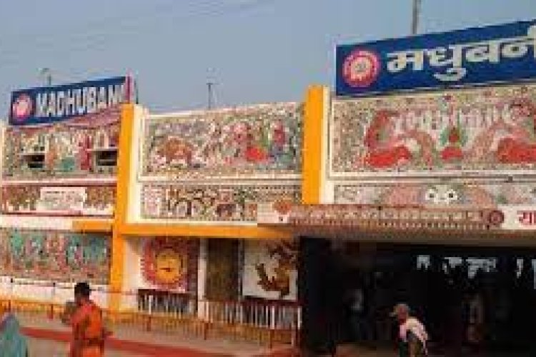
25. Madhubani, Bihar
The district of Madhubani was carved out of the old Darbhanga district in the year 1972 as a result of reorganization of the districts in the State of Bihar. This was formerly the northern subdivision of Darbhanga district. It consists of 21 Development Blocks. Bounded on the north by a hill region of Nepal and extending to the border of its parent district Darbhanga in the south, Sitamarhi in the west and Supaul in the east, Madhubani fairly represents the center of the territory once known as Mithila and the district has maintained a distinct individuality of its own.
There are practically no prehistoric sites in the district though remains of the earliest aboriginal population can be seen in some parts of the district. Hunter in his “Statistical Accounts” has referred to the existence of the people, known as the Tharus in the erstwhile old subdivision of Madhubani. The Bhars are also believed to have belonged to some aboriginal race though nothing positive about them is known from any reliable source. The Bihar settlements in the north-eastern part of the district indicate that they possibly wielded some power in the remote part. From the work of Dr. Suniti Kumar Chatterji entitled ‘Kiratajanakirti’ it appears that Kiratas also inhabited the district for a considerable period. The Mahabharata also throws light on the Kirata culture. Prior to the Aryanisation of this land the area seems to have been under the aboriginal population and Shiva worship was predominant. The association of the family of Janaka with the worship of lord Shiva is an indication of the fact that though they formed the vanguard of Aryan culture they had to compromise with the local religious belief, dominated by the Shaivas. The kingdom of Videha included a greater portion of the district. In course of time, it was ruled by a successive line of kings known as Janakas.
If tradition is to be relied upon, the Pandavas during their exile stayed in some portion of the present district and Pandaul (block headquarters) is associated with them. Janakpur, capital of Videha is situated at a short distance to the north-west of the district in the Nepalese territory and tradition points to the village of Phulhar in the north- east corner of the Benipatti thana as the flower- garden where the kings’ priests used to gather flowers for worship and identifies its temple with that of Devi Girija, which was worshipped by Sita before her marriage with Ram. Legends and traditions associate this district with a number of sages and master- minds of ancient times. Village Kakraul is associated with Kapil, Ahiari with Ahilya wife of Gautama, Bisaul with Vishwamitra and Jagban with Yajnavalkya (ascribed to the great sage of Mithila).
26. Munger, Bihar
The territory included within the district of Munger (famously Monghyr) formed pent of the Madhya-Desa as “Midland” of the first Aryan settlers. It has been identified with Mod-Giri a place mentioned in the Mahabharata, which was the capital of a kingdom in Eastern India near Vanga and Tamralipta. In the Digvijaya Parva of Mahabharata, we find the mention of Moda-Giri, which seems similar to Moda-Giri. Digvijaya Parva suggests that it was a monarchical state during early times. A passage in the Sabha-Parva describes Bhima’s conquest in Eastern India and says that after defeating Karna, king of Anga, he fought battle at Modagiri and killed its chief. It was also known as Maudal after Maudgalya, a disciple of Buddha, who converted a rich merchant of this place into Buddhism. Buchanan says that it was the hermitage of Mudgala Muni and this tradition of Mudgal Risi still persists. Munger is called “Modagiri” in the Monghyr copperplate of Devapala. The derivation of the name Munger (Monghyr) has found the subject of much speculation. Tradition ascribes the foundation of the town to Chandragupta, after whom it was called Guptagars a name which has been found inscribed on a rock at Kastaharni Ghat at the north-western corner of the present fort. It is insisted that Mudgalrisi lived there. Tradition ascribes the composition of various suktar of the 10th Mavdala of the Rigveda to Rishi Mudgal and his clan. However, General Cunnigham had strong suspicion when he connects this original name with Mons as Mundas, who occupied this part before the advent of the Aryans. Again Mr. C.E.A. Oldham, ICS, a farmer collector suggests the possibility of Munigiha, ie , the abode of the Muni, without any specification which later corrupted Mungir and later became Munger.
27. Muzaffarpur, Bihar
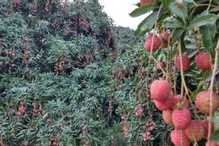
Muzaffarpur District, ‘The Land of Leechi’ was created in 1875 for the sake of administrative convenience by splitting up the earlier district of Tirhut. The present district of Muzaffarpur came to its existence in the 18th century and named after Muzaffar Khan, an Amil (Revenue Officer) under British Dynasty. Purbi Champaran and Sitamarhi districts on North, on the South Vaishali and Saran districts, on the East Darbhanga and Samastipur districts and on the West Saran and Gopalganj districts surround Muzaffarpur. Now it has won international encomiums for its delicious Shahi Leechi and China Leechi.
It is, of course impossible to trace back the history of this region to its earliest origins, but we can trace back it’s stream of strong heritage a very long way through the ancient Indian epic Ramayana, which still bears a significant role in Indian civilization. To initiate with the Legend, Rajarshi Janak was ruling Videha, the mythological name of this entire region including eastern Nepal and northern Bihar. Sitamarhi, a place in this region, bears a value of sacred Hindu belief where, Seeta (other name Vaidehi: The Princes of Videha) sprang to life out of an earthen pot while Rajarshi Janak was tilling the land.
28. Rohtas, Bihar
Rohtas has an old & interesting history. In pre-historic days the plateau region of the district has been the abode of aboriginals whose chief representatives now are the Bhars, the Cheers and the Oraons. According to some legends the Kherwars were the original settlers in the hilly tracts near Rohtas. The Oraons also claim that they ruled over the area between Rohtas and Patna. The local legend also connects king Sahasrabahu with Sasaram, the headquarter of Rohtas district. It is believed that Sahasrabahu had terrible fight with Saint Parsuram, the legendary Brahmin Protector, as a result of which Sahasrabahu was killed. The term Sahasram is supposed to have been derived from Sahasrabahu and Parsuram. Another legend connects the ROHTAS hill to Rohitashwa, son of Raja Harishchandra, a famous king who was known for his piety and truthfulness.
The District of ROHTAS formed a part of the Magadh Empire from 6th B.C. to 5th Century A.D. under the pre Mauryans. The minor rock edict of Emperor Ashok at Chandan Sahid near Sasaram confirmed the Mauryans conquests of this district. In the 7th Century A.D. This district came under the control of Harsha rulers of Kannauj.
Sher Shah’s father Hassan Khan Suri was an Afghan adventure, he got the jagir of Sasaram as a reward for his services to Jamal Khan, and the Governor of Province during the latter’s attachment with the king of Jaunpur. But the Afghan Jagirdar was not able to exercise full control over this subject since the allegiance of the people was very lose and the landlords were particularly independent. In 1529 Babar invaded Bihar, Sher Shah who lost opposed him. Babar has left in his memories an interesting account of the place. He mentioned about the superstitions of the Hindu with regard to river Karamnasa and also described how he swam across the river Ganga at Buxar in 1528.
29. Lakhisarai, Bihar
akhisarai was an established administrative and religious centre during the golden period of Pal bansh. This region of Lakhisarai was identified in old times as a place of rocks, mountains and statues of different Hindu and Bhuddhist gods and goddesses. Even in Buddha literature this place had been mentioned as “Anguttri” meaning thereby a district status. This beautiful place, named Lakhisarai came into existence as a new district from Munger. Hence this place in the ancient period also can be identified with the name of Munger or Ang Pradesh. Lakhisarai region during Pal administration was the capital of Pals for some period. Other evidence was found in the district under the Pal Dharampal.
Noted Historian Dr. D.C. Sarkar during his visit, found some more evidence on the basis of which, he also confirmed that this place was very important “Krimila” Subject during Pal administration. The monument of Madan Pal of period 1161-1162 was found in Balgudar consist Narayana statue as Krimila Subject. Chinese traveler Huen Tsang described this place having 10 Buddha mathas and more than four hundred Buddhists resided here. Most of the Buddhists living here were Heenyanis. There were 10 temples also of Hindus and people lived here in peace and harmony. People of that time used to live in a very planned manner. Also, according to historian Sri Radha Krishna Chaudhary all the Buddha mathas were situated in southern side of Ganga and the king of Pal Bans was also a Buddhist. This region of Lakhisarai was ruled over from the seventh century to the eleventh century by the administrator of Pal Bans. The Sen family also ruled this region for some period in the 11th century. Acharya Hawaldar Tripathi mentioned this region of Lakhisarai on the basis of “Mritika Mudra” kept in Nalanda. It means that Krimila was very important and Caval Gram was very important. The people believe that Krimila of that period is now Kiul Basti, which is situated in Southern side of Lakhisarai Railways station. Krimila was a center of Buddhist religion. Lord Buddha also stayed here for three years on Chaliya Mountain and Jantugram was nearby Chliya mountain and was situated on bank of river Krimikala, where Lord Buddha with his followers used to visit and deliver speech. It is convincing that Krimikala is now in Kiul river and Chaliya mountain is nothing but Jainagar mountain.
History indicates also that Md. Bin Bakhtiyar attacked this region in the 11th century. Sher shah also ruled this region in the 15th century. Surrajgarha witnessed the great war of Sher shah and Mughal emperor Humayu in 1534. Also, in 1953 a fight occurred in Fatehpurnear Surajgarha between Miya Suleman and Adlshah in which Adil shah was killed.
In religious context, Surajgarha was also an important place for Shaiva sect. One beautiful Shiv Mandir was there and a large number of people gathered there for worship of Lord Shiva with religious devotion.
There are some other places in this district, which are significant or were known for its significance in ancient period, either in Historical, archaeological or in religious context.
30. Vaishali, Bihar
Believed to be the first republic in the world, Vaishali has taken its name from King Vishal of the Mahabharat age. He is said to have constructed a great fort here, which is now in ruins. Vaishali is a great Buddhist pilgrimage and also the birthplace of Lord Mahavira. It is said that the Buddha visited this place thrice and spent quite a long time here. The Buddha also delivered his last sermon at Vaishali and announced his Nirvana here. After his death, Vaishali also held the second Buddhist Council.
The great Lichchavi clan ruled Vaishali in the sixth century BC, and the empire extended up to the hills of Nepal. The Lichchavi state is considered to be the first republican state of Asia. According to the Jataka stories, (Buddhist story books giving the account of different births of the Buddha), Vaishali was ruled by some 7707 kings of the Lichchavi clan. Ajatshatru, the great Magadh King, annexed Vaishali in the fifth century BC and after that Vaishali gradually lost its glory and power.
Mahavira, the last Tirthankar of Jainism, was born in Kundupur near Vaishali. The father of Mahavira was King Siddartha and his mother Trishala was the sister of King Chetaka of Vaishali. Since the wealth of his father’s kingdom had increased during the pregnancy, the child was called Vardhaman. He was named Mahavira because he showed great courage at a very young age. After the death of his parents at the age of 30, he renounced the world after fasting for two days under an Ashoka Believed to be the first republic in the world, Vaishali has taken its name from King Vishal of the Mahabharat age. He is said to have constructed a great fort here, which is now in ruins. Vaishali is a great Buddhist pilgrimage and also the birthplace of Lord Mahavira. It is said that the Buddha visited this place thrice and spent quite a long time here. The Buddha also delivered his last sermon at Vaishali and announced his Nirvana here. After his death, Vaishali also held the second Buddhist Council.
31. Saharsa, Bihar
Saharsa was also made headquarters of Kosi division on 2 October 1972, comprising Saharsa, Purnia and Katihar district, with its earlier, the Saharsa district was part of the Munger and Bhagalpur districts. On 1 April 1954 it was made a district of its own. headquarters in Saharsa. Similarly, a new Civil Sub-Division Birpur was created on 1 December 1972, consisting of 24 development blocks, including Raghopur, Chhatapur, Basantpur and Nirmali, which were previously under Supaul subdivision of the district. Two new districts, Madhepura and Supaul, were formed from Saharsa district on 30 April 1981 and 1991. Saharsa district now consists of two subdivisions, Saharsa Sadar and Simri Bakhtiarpur. The district consists of 10 development blocks and Anchal's each.
A large part of the district in the past was subjected to annual floods and inundation by a host of rivers originating from the Himalayas. The sub terai was noted for rice cultivation before it was subjected to the vagaries of the unpredictable Koshi river.
32. Samastipur, Bihar
Darbhanga came under the control of the Oinwaras, also known as the Kameshwara Thakur or Sugauna Dynasty. These Hindu Chiefs were left undisturbed by the Muslim conquerors, who has by now conquered the whole of Mithila and whose exploits are indicated. The Oinwara Dynasty is noted for its encouragement of leaning and fine arts and their court served as the center of Sanskrit belle’s letters and philosophy. Among the prominent scholars of age were Gadadhara, Sankara, Vachaspati Mishra, Vidyapati, Amartakara and Amiykara. Kameshwara, the founder of dynasty, was resident of village Oini, near Pusa Road, in the District of Darbhanga. When Hazi Ilyas of Bengal divided Tirhut into two parts, the Oinwara Raja shifted his Capital to Sugauna near Madhubani. The southern part of the district was under Hazi Ilyas and the northern part under the Oinwaras. The modern subdivision of Samastipur (originally Shamsuddinpur) was founded by Hazi Shamsuddin Ilyas of West Bengal.
Samastipur became a district in 1972 when it was split from Darbhanga district.
33. Saran, Bihar
The historical background of the district as available in Ain-E-Akbari records Saran as one of the six Sarkars (Revenue Divisions) constituting the province of Bihar, At the time of grant of Diwani to the East India company in 1765, there were eight Sarkars including Saran and Champaran. These two were later combined to form a single unit named Saran. Saran (along the historical background of the district- as available with Champaran) was included in the Patna Division when the Commissioner’s Divisions were set up in 1829. It was separated from Champaran in 1866 when it (Champaran) was constituted into a separate district. Saran was made a part of Tirhut Division when the latter was created in 1908. By this time there were three subdivisions in this district namely Saran, Siwan and Gopalganj. In 1972 each subdivision of the old Saran district became an independent district. The new Saran district after separation of Siwan and Gopalganj still has its headquarters at Chapra.
Various hypotheses have been put forward about the origin of the name SARAN. General Cunningham suggested that Saran was earlier known as SARAN or asylum which was a name given to a stupa (Pillar) built by emperor Ashoka. Another view holds that the name SARAN has been derived from SARANGA- ARANYA or the deer forest, the district being famous for its wide expanses of forest and deer in prehistoric times. The earliest authentic historical fact or record concerning this district may perhaps be related to 898 A.D which suggest that the village of Dighwara dubauli in Saran had supplied a copper plate issued in the reign of king Mahendra paldevass.
34. Sitamarhi, Bihar
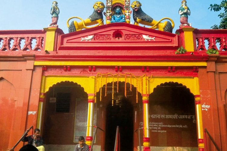
The district of Sitamarhi was carved out of Muzaffarpur district on 11th December 1972. It is situated in the northern part of Bihar. It headquarters is located at Dumra, five kilometers south of Sitamarhi. The district headquarters was shifted here after the town of Sitamarhi was devastated in one of the worst ever earthquakes in January 1934.
Sitamarhi is a sacred place in Hindu mythology. Its history goes back to Treta Yug. Sita, the wife of Lord Rama sprang to life out of an earthern pot, when Raja Janak was ploughing the field somewhere near Sitamarhi to impress upon Lord Indra for rain. It is said that Raja Janak excavated a tank at the place where Sita emerged and after her marriage set up the stone figures of Rama, Sita and Lakshman to mark the site. This tank is known as Janaki-kund and is south of the Janaki Mandir.
In course of time, the land lapsed into a jungle until about 500 years ago, when a Hindu ascetic, named Birbal Das came to know the site by divine inspiration where Sita was born. He came down from Ayodhya and cleared the jungle. He found the images set up by Raja Janak, built temple over there and commenced the worship of Janaki or Sita. The Janaki Mandir is apparently modern and is about 100 years old only. The town however contains no relics of archaeological interest
35. Siwan, Bihar
Siwan also has a lot of mythological importance attached to it. Don, a village located in the Darauli region, has the ruins of a fort, believed to have belonged to the great guru in Mahabharata, who taught Kauravas and Pandavas and who was a leading figure in the Mahabharata war. In fact, his son Ashwathama is believed to be still wandering the earth because of a curse by Lord Krishna for killing the sons of the Pandavas. Don is also known for a stupa, which is believed to have the vase in which Buddha’s ashes were kept. It is believed that Don was the name of a local Brahmin who helped the dispute among the last followers of Buddha regarding how Buddha’s ashes could be distributed.As a token of gratitude, the vase which contained the ashes was given to Don. He built a stupa to place the vase. The stupa, though in ruins, is still a revered place for Buddhists. In fact, the famous Chinese traveler, Hiusen Tsang has mentioned about Don in his travelogue. It is also believed that Buddha must have breathed his last somewhere here. The statue of Siwan has acquired more importance recently after the excavation of an idol of Lord Vishnu from the village Bherbania in Siwan district.
36. Supaul, Bihar
Supaul District is one among 38 Districts of Bihar State, India. Supaul District Administrative head quarter is Supaul. It is is Located 184 KM west towards State capital Patna. Supaul District population is 2228397. It is 23 rd. Largest District in the State by population.
37. Seohar, Bihar
The district of Sheohar, which till the 1991 Census was a part of Sitamarhi district as one of its subdivisions, was elevated to the status of a district on 6th October, 1994 by the Government of Bihar vide its Notification No. 286. The district is situated in the northern part of Tirhut Division and lies in the extreme north region of the state of Bihar. It is surrounded on the north and east by the district of Sitamarhi, on the south by the district of Muzaffarpur and on the west by the district of Purba Champaran. It is one of the historical districts in the State of Bihar both in terms of size of population and total area of the district. The district has only one subdivision viz. Sheohar and five C.D. Blocks viz., Sheohar, Piprahi, Purnahiya, Dumri Katsari and Tariyani Chowk. Sheohar is the only town in the district. There are altogether 53 panchayats comprising 203 villages in the district
38. Sheikhupura, Bihar
Sheikhupura is a district in the Bihar State of India. Total area of Sheikhupura is 689 km² including 645.50 km² rural area and 43.50 km² urban area. As per 2011 stats, Sheikhupura has a population of 6,36,342 people, out of which urban population is 1,09,002 while rural population is 5,27,340. The district has a population density of 924 inhabitants per square kilometer. There are about 1,00,701 houses in the district, including 17,796 urban houses and 82,905 rural houses. When it comes to villages, there are about 261 villages in Sheikhupura district.
The Sheikhupura district is further divided into Subdivisions / Blocks / Community Development Blocks (C.D. Blocks) for administrative purposes. In India, the Block or C.D. Block is often the next level of administrative division after the tehsil. It is important to note that, in some states of India C.D. Blocks are equal to tehsils.

